Government

Rigorous quality controlled aerial imagery according to the latest international standards and regulations

HxGN Content - Industries - Government

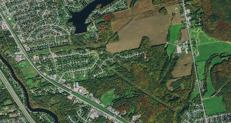
Map flood areas for emergency management, perform change detection surveys for tax purposes, track public assets or manage your cadastre with base maps from the HxGN Content Program. The high resolution ortho imagery is stored with all relevant meta data and processed by experienced photogrammetrists according to international standards.

A well-connected network of resellers are always on hand to support you on state, county or municipal level to ensure the required data is delivered to spec and on time so that you can save on custom acquisition. Aerial imagery is a valuable tool to evaluate ground structures, especially during times of disaster or alteration, to define land and property or to perform change detection surveys. The HxGN Content Program delivers quality controlled and seam line corrected imagery at 15 cm resolution for urban area coverage and 30 cm resolution for wide area coverage.

Tracking critical assets


Keep track of assets down to individual buildings, roads, vegetation, utility, infrastructure and light posts with 15 cm resolution urban coverage and guaranteed no cloud coverage. Streaming the imagery will support your GIS programme with the highest quality base map.

Boundary management


Facilitate boundary survey with imagery that is updated on a regular refresh schedule and directly streamed into your GIS application of choice. Working within any third-party software makes it easy to share results with your counterparts in counties and municipalities.  

Managing risks


Model floods, evaluate damages, assess coast lines and determine changes. The HxGN Content Program high resolution imagery will help you to better understand developments within your boundaries. Streaming services will allow you to instantly see the latest data.

Wide areas


Carry out city or state-wide analysis, evaluate pervious and impervious surface ratios, create detailed maps and models based on highly accurate and quality controlled data. Share information with all stakeholders across your state or county.

Téléchargements
Brochure 3D2017
Parcs de stationnement autour de 3D2017